
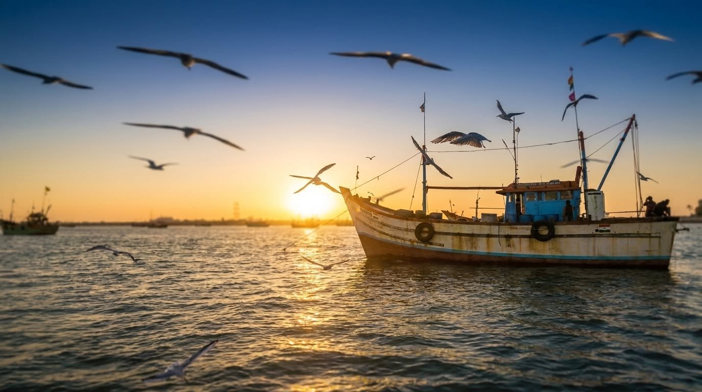
Bet Dwarka, an inhabited island situated precisely at the mouth of the Gulf of Kutch in the Arabian Sea, represents one of the most culturally dense, archaeologically significant, and ecologically diverse landscapes in Western India. Located approximately 2 kilometers off the coast of the Okha mainland in Gujarat and roughly 25 kilometers north of the ancient city of Dwarka, the island features a sandstone topography measuring approximately 8 kilometers in length with an average width of 2 kilometers. While its geographic footprint is relatively small, its historical, geopolitical, and mythological significance resonates on a global scale.
For centuries, the island’s isolation was maintained by the turbulent waters of the Arabian Sea, fostering a unique, self-contained ecosystem of religious asceticism, specialized maritime trade, and distinct architectural development. Today, however, modern developmental paradigms most notably the 2024 inauguration of the Sudarshan Setu, India’s longest cable-stayed bridge have rapidly transformed the island’s accessibility. This infrastructure megaproject bridges the physical and temporal gap between the island’s secluded antiquity and contemporary domestic tourism networks. This report provides an exhaustive synthesis of Bet Dwarka, dissecting its etymological roots, mythological frameworks, marine archaeological discoveries, ecclesiastical architecture, coastal ecology, and the vast infrastructural and logistical developments dictating its modern socioeconomic trajectory.
Geographic Orientation and Etymological Origins
The physical landscape of Bet Dwarka is defined by coastal alluvial plains and a sandstone foundation, fringed by extensive sand beaches, vibrant coral reefs, and protective mangrove ecosystems. This littoral environment leaves the island highly susceptible to the tidal fluctuations and climatic forces of the Arabian Sea, a geological reality that has fundamentally shaped its history of habitation, abandonment, and resettlement.
The nomenclature of the island reveals its deeply layered cultural identity. Historically and locally, the island is widely referred to as “Shankhodhar,” a title derived directly from the abundant natural reserves of conch shells (shankha) found along its shores. These marine shells have driven local micro-economies since the protohistoric period, serving both as ritualistic artifacts and commodities for export. Furthermore, religious lore asserts that Lord Krishna lifted a conch shell from this specific geographical location to sound the commencement of the epic Mahabharata war.
The contemporary name, “Bet Dwarka,” possesses dual linguistic and theological origins. In the standard Gujarati linguistic context, the word “bet” translates simply to “island”. However, within the theological narratives of Vaishnavism, “bet” translates to “gift” or “meeting”. This translation is rooted in the foundational mythology of Lord Krishna receiving a humble gift of beaten rice from his impoverished childhood friend, Sudama, upon their meeting at this specific geographic locale. Furthermore, in the ancient Indian epic, the Mahabharata specifically within the text of the Sabha Parva the island is referred to as “Antardvipa” (the inner island). The esteemed Gujarati scholar Umashankar Joshi identified Antardvipa as Bet Dwarka, describing it as a secluded sanctuary to which the members of the Yadava clan were required to travel by boat.
Mythological Framework and Spiritual Topography
Within the broader cosmology of Hinduism, Bet Dwarka is universally revered as the original residential domain of Lord Krishna during his administrative reign over the Yadava dynasty. This mythological distinction separates it from mainland Dwarka, which functioned strictly as the administrative and ruling capital. According to scriptural tradition, particularly texts such as the Skanda Purana and the Garga Samhita, the original fortified city was engineered by the divine architect Vishwakarma at the explicit behest of Krishna. Subsequent legends indicate that following Krishna’s departure from the mortal realm, large swathes of this divine, gold-roofed city were subsumed by the ocean, leaving only the present-day island as a terrestrial remnant.
The island forms a critical, non-negotiable node in the “Pancha Dwarka” (Five Dwarkas) pilgrimage circuit, a highly structured spiritual journey for Vaishnava devotees. Beyond standard Vaishnava reverence, the island holds profound, specialized significance within the Pushtimarg tradition, a sub-sect of Vaishnavism founded by the philosopher Guru Vallabhacharya. Bet Dwarka is home to the 62nd Baithakji (sacred resting and discourse site) of Shri Mahaprabhuji.
The theological structure of Pushtimarg dictates that this Baithak manifests simultaneously in three divine forms, shaping the spiritual psychology of the pilgrim. The Adhibhautik Svaroopa represents the physical, observable structure visible to all visitors. The Adhyatmika Svaroopa encompasses the spiritual dimension, representing the divine pastimes and events that occurred at the site. Finally, the Adhidaivika Svaroopa represents the purely transcendental form. This complex, layered theological framework dictates the specific liturgical practices and pilgrimage behaviors observed on the island today, where devotees engage in structured Darshan (reverent viewing) and Seva (spiritual service) to facilitate spiritual transcendence.
Marine Archaeology and the Late Harappan Horizon
For centuries, the narratives of submerged golden cities and ancient maritime wealth were relegated to the domain of pure mythology. However, rigorous undersea and intertidal explorations conducted by the Marine Archaeology Centre of the National Institute of Oceanography (NIO), Goa, spanning from 1981 to 1994 under the direction of the distinguished Indian archaeologist Professor S.R. Rao, transitioned Bet Dwarka from a site of myth to a site of verified protohistoric antiquity.
Structural Discoveries and Artifacts
Explorations along the shore and the intertidal zones unearthed substantial structural remnants that fundamentally altered the historical timeline of the region. Most notably, during the 1982 excavation season, archaeologists discovered a massive, 580-meter-long submerged protection wall, reliably dated via chronometric and typological methods to circa 1500 BCE. The inundation of this massive fortification is attributed to continuous coastal erosion and violent sea storms, corroborating the cultural memory of a city reclaimed by the ocean.
Excavations within the fortified settlement yielded a wealth of artifacts from the Late Harappan period, indicating a highly sophisticated urban environment. Recovered items include a Late Harappan seal, sturdy copper fishhooks, an inscribed jar, and a specialized coppersmith’s mold. The presence of a citadel, specific habitation annexes, and dedicated factory sites points toward advanced, systematic town planning characteristic of the Indus Valley Civilization.
The Protohistoric Molluscan Shell Industry
A highly specialized, industrial-scale operation centered around marine gastropods was active on the island during antiquity. Archaeological shell analysis reveals that large, heavy marine species specifically Turbinella pyrum and Chicoreus ramosus were harvested and processed systematically. The settlement featured warehouses and factory floors dedicated almost exclusively to the manufacture of shell bangles and ladles. Demonstrating a high degree of resource efficiency, the resulting waste material from the primary manufacturing process was repurposed to create secondary luxury objects such as beads and decorative inlays.
Ancient Maritime Trade Networks
The island’s strategic position at the mouth of the Gulf of Kutch made it a pivotal node in ancient maritime trade routes, transforming it into a landscape of cultural encounters where mercantile societies thrived on the circulation of commodities and ideas. The discovery of numerous shipwrecks and heavy stone anchors in the surrounding seabed highlights the island’s role as a major port. Specifically, the unearthing of triangular stone anchors featuring three holes points directly to robust, historical trade relations with the Roman Empire and the broader Arabian peninsula.
The archaeological timeline synthesized from these excavations suggests that the earliest protohistoric settlement peaked around 1400 BCE during the late phase of the Indus Valley Civilization. The site was subsequently deserted for several centuries likely due to tectonic shifts, changing sea levels, or severe coastal erosion before being re-occupied during the Mauryan Empire in the 3rd century BCE. This cyclical pattern of habitation, abandonment, and resettlement highlights a broader socio-economic paradigm wherein mercantile communities demonstrated high social resilience, continually adapting their port infrastructure to volatile littoral environments to maintain lucrative global maritime networks.
Political History: From the Maitrakas to the Vagher Rebellion
The historical record of Bet Dwarka transitions from archaeological evidence to epigraphic documentation in the 6th century CE. A copper plate inscription dated 574 CE, issued by Simhaditya a minister of the city of Vallabhi during the Maitraka dynasty and the son of Varahdas, the regional king of Dwarka provides concrete evidence of the region’s geopolitical administration during this era, confirming its sustained historical significance.
By the 18th century, the island, alongside the broader Okhamandal region, fell under the administrative control of the Gaekwads of the princely state of Baroda. The most turbulent period in its modern history occurred during the Indian Rebellion of 1857, when local Vagher rebels launched a successful maritime and land-based attack, capturing the island and challenging the existing feudal and colonial power structures.
The Vagher occupation, however, was short-lived. In 1859, a joint military offensive executed by British forces and Gaekwad state troops ousted the rebels, restoring the island to the Baroda state. Following Indian independence in 1947, the region was integrated into the Saurashtra state, subsequently merging with Bombay State. Upon the linguistic reorganization of states and the formation of Gujarat, Bet Dwarka was absorbed into the Jamnagar district, which was later bifurcated, placing the island under the jurisdiction of the newly created Devbhumi Dwarka district.
Architectural and Ritualistic Dimensions of Island Shrines
The built environment of Bet Dwarka is dominated by a high density of religious structures, the majority of which were constructed or extensively renovated toward the end of the 18th century following periods of destruction by invading forces, such as the Mahmud Begada rulers.
Shri Keshavraiji (Dwarkadhish) Temple
The primary nucleus of worship and economic activity on the island is the Dwarkadhish Temple (Shri Keshavraiji Temple), dedicated to Lord Krishna and believed by devotees to be situated directly over his original residential palace. The establishment of the current temple structure is credited to Guru Vallabhacharya over 500 years ago. The temple’s architecture is notably simpler and more austere than the towering, intricately carved Jagat Mandir in mainland Dwarka, devoid of an elaborate shikhara (spire) and featuring a more grounded, residential aesthetic.
The sanctum sanctorum houses an idol of Krishna that bears a striking resemblance to the deity in the mainland Dwarka temple. However, there is one distinct iconographic variation: the Bet Dwarka idol holds the conch shell (shankha) in an oblique position. Tradition asserts that this specific idol was crafted and established by Krishna’s primary consort, Devi Rukmini, over 5,000 years ago, highlighting the deep matriarchal ties to the site’s ongoing worship.
In a direct, physical continuation of the Sudama mythological narrative, the primary offering made by devotees at this temple is raw rice, symbolizing the gift that secured Krishna’s eternal friendship and blessings. The ritualistic schedule is highly structured, divided into distinct viewing periods (darshan) interspersed with periods where the sanctum is closed for internal rituals (bhog and anosar), reflecting the anthropomorphic treatment of the deity. Mobile phones and cameras are strictly prohibited inside the complex, forcing a highly localized and distraction-free spiritual engagement.
| Ritual / Activity | Approximate Timing | Access Status |
| Mangala Aarti | 6:30 AM | Open |
| Shringar Darshan | 9:00 AM – 10:15 AM | Open (with intermittent closures for Snanbhog) |
| Gwal Bhog | 11:05 AM – 11:20 AM | Closed |
| Rajbhog (Midday Royal Meal) | 12:00 PM – 12:20 PM | Closed |
| Anosar (Midday Rest Period) | 12:30/1:00 PM – 5:00 PM | Closed to Public |
| Sandhya Aarti | 7:30 PM | Open |
| Shayan Aarti (Bedtime Ritual) | 8:30 PM | Open |
| Temple Closure | 9:30 PM | Closed |
Table 1: Standard Daily Ritual Schedule at the Dwarkadhish Temple complexes. Timings are subject to seasonal and festival variations, particularly during Janmashtami when the temple remains open throughout the night.
The complex also houses subsidiary shrines dedicated to Krishna’s family, including Balarama, Pradyuman, Devaki, Satyabhama, and Jambavati. Interestingly, a shrine dedicated to Radha (Golak Mata temple) exists just outside the main circle of shrines, depicting her distinct but highly revered status in Krishna’s life.
Dandi Hanuman Temple and the Makardhwaja Legend
Located approximately five kilometers east of the main Krishna temple is the Dandi Hanuman Temple, an architectural and theological anomaly in Hindu iconography. This is the only known temple where Lord Hanuman is worshipped alongside his son, Makardhwaja.
The mythology, rooted in medieval adaptations of the Ramayana (such as the Ananda Ramayana and the Bengali Krittivasi Ramayana), dictates that after setting fire to Lanka, Hanuman extinguished his burning tail in the ocean. A drop of his sweat imbued with his immense power and divine celibacy was swallowed by a Makara (a mythical aquatic creature, often depicted as a fish-crocodile hybrid), resulting in the miraculous conception of Makardhwaja. The child was subsequently discovered and raised by Ahiravana (or Mahiravana), the demon king of the subterranean realm of Patala, who appointed him as the loyal gatekeeper of the netherworld.
When Hanuman later descended into Patala to rescue Lord Rama and Lakshmana from Ahiravana’s sacrificial plot, he was forced into fierce combat with Makardhwaja. Bound by dharma to his adoptive father, Makardhwaja fought valiantly until the paternal bond was revealed during the duel, highlighting themes of unexpected lineage and heroic destiny.
The iconography of the Dandi Hanuman Temple is highly specific to the regional Maharashtra Bajanasampradhaya. Unlike traditional, pan-Indian depictions of Hanuman that emphasize martial duty, aggression, and strength, both Hanuman and Makardhwaja are depicted here in a profoundly relaxed, joyous state. Crucially, neither deity holds a weapon in their hands. Their traditional staff (danda/club) is placed on the ground between them, symbolizing a complete cessation of hostilities and a prioritization of paternal affection over strife. In the Gujarati dialect, “Dandi” is synonymous with a joyous, merry, or ecstatic mood, thereby granting the temple its name: the “Joyous Hanuman Temple”. Devotees frequently visit this shrine specifically to seek blessings for family bonds and to resolve paternal disputes.
Sikh Heritage: The Legacy of Bhai Mohkam Singh
The religious topography of Bet Dwarka extends beyond Hinduism, holding profound significance in Sikh history. The island is the birthplace of Bhai Mohkam Singh (born Mohkam Chand on June 6, 1663), one of the inaugural Panj Pyare (The Five Beloved Ones).
Born to Tirath Chand and Devi Bai, a family belonging to the Chhimba caste (traditional cloth printers and tailors), Mohkam Chand traveled to Anandpur around 1685, which was then the seat of Guru Gobind Singh. There, he trained extensively in martial arts and participated in numerous battles against surrounding hill chiefs and imperial Mughal troops. During the monumental assembly at Anandpur Sahib on Baisakhi day in 1699, Mohkam Chand was one of the first five men to offer his head in response to Guru Gobind Singh’s call, earning the appellation of Panj Pyare. Initiated into the order of the Khalsa, he received the surname “Singh” and came to represent the virtue of Mohkam (steadfastness/discipline).
Bhai Mohkam Singh ultimately sacrificed his life alongside Bhai Himmat Singh and Bhai Sahib Singh at the Battle of Chamkaur on December 7, 1704 (or 1705). To commemorate his birth and his monumental contribution to the foundation of the Khalsa Panth, a Gurudwara was constructed on Bet Dwarka in 1999, adding a vital layer of pluralistic heritage to the island.
Coastal Ecology, Ecotourism, and the Marine Sanctuary at Dunny Point
Beyond its religious and historical gravity, the geography of Bet Dwarka hosts a fragile, vibrant, and largely pristine coastal ecosystem. The easternmost tip of the island narrows into a thin peninsula known as Dunny Point, surrounded on three sides by the waters of the Arabian Sea.
Dunny Point is recognized as the first site in Gujarat deliberately developed for ecotourism. Unlike the heavily commercialized mainland beaches, Dunny Point operates entirely off the grid. It lacks electricity, mobile network connectivity, and paved roads, enforcing a complete digital detox and immersion in nature for its visitors. Access to this remote wilderness is primarily facilitated through specialized marine camping operators who arrange boat transport directly from Okha or the main island.
The intertidal zones and clear blue waters surrounding Dunny Point act as a natural marine sanctuary, protected from the heavy pollution of commercial shipping lanes. Ecological explorations during low tide reveal a high density of marine life, including complex coral formations, sponges, sea anemones, pufferfish, octopuses, sea snakes, starfish, and various colorful crab species. Local marine guides facilitate these explorations, ensuring the safety of both the tourists and the fragile ecosystems. Furthermore, the deeper waters serve as a natural habitat for dolphins, making dolphin exploration safaris via boat a primary attraction during the winter months (October to March).
Tourism packages for these wilderness camps are designed for budget-conscious adventure travelers, with prices ranging from approximately Rs 999 for a day exploration to Rs 2,599 – Rs 2,999 for overnight beachfront glamping experiences that include meals, marine walks, and campfires. The intersection of unchecked mass religious tourism on the main island and the delicate marine biology at Dunny Point necessitates stringent ecological management to prevent habitat degradation and preserve the island’s unique biodiversity.
Modern Infrastructural Megaprojects: The Sudarshan Setu
For millennia, access to Bet Dwarka was entirely, inflexibly dependent on maritime transport. In the modern era, this manifested as a fleet of public and private passenger ferries operating out of the Okha shipyard. While inexpensive public boat fares range from Rs 10 to Rs 30 for the 15-to-20-minute crossing this dependency severely limited island accessibility. Travel was restricted strictly to daylight hours (typically 6:00 AM to 7:00 PM), and access was routinely severed during the turbulent monsoon months or during periods of rough coastal weather.
This historical logistical bottleneck was permanently resolved on February 25, 2024, with the official inauguration of the Sudarshan Setu (formerly known as the Okha-Beyt Dwarka Signature Bridge) by Prime Minister Narendra Modi. The construction of the bridge, initially approved by Union Transport Minister Nitin Gadkari in 2016 with the foundation stone laid in 2017, was executed by SP Singla Construction Pvt Ltd at a total cost of Rs 979 crore. It represents a monumental leap in Indian civil and coastal engineering.
Engineering and Architectural Specifications
The Sudarshan Setu is a cable-stayed bridge spanning a total length of 2,320 meters (2.32 kilometers), officially distinguishing it as the longest cable-stayed bridge in India.
| Structural Specification | Dimension / Detail |
| Total Length | 2,320 meters (2.32 km) |
| Total Width | 27.2 meters |
| Carriageway | 4 Lanes (two in each direction) |
| Pedestrian Walkways | 2.5 meters wide on each side |
| Central Cable Section | 900 meters |
| Main Span | 500 meters (Longest in India) |
| Support System | 34 piers in the water |
| Pylon Height | 129.985 meters (approx. 130m) |
| Pylon Design | A-shaped, curved, leaning back up to 22 meters |
Table 2: Structural and Architectural Specifications of the Sudarshan Setu.
The bridge’s superstructure relies on a composite steel-reinforced concrete deck supported by cables arranged in a highly efficient fan configuration. The immense load of the bridge is distributed through 34 piers set into the seabed and anchored by two towering A-shaped composite pylons. To ensure aerodynamic stability and structural integrity against the extreme wind loads typical of the Gulf of Kutch, the pylons tilt away from their vertical axis in the rear span, leaning outward by up to 22 meters from the center base, granting the structure a distinctive, fan-like aesthetic.
Sustainable and Cultural Integration
The bridge’s design transcends pure vehicular utility by integrating deep cultural motifs and modern renewable energy infrastructure. The 2.5-meter-wide pedestrian pathways on both flanks are shaded by structures clad entirely with solar panels, generating approximately 1 Megawatt (MW) of electricity, enough to power the bridge’s illumination and contribute to the local grid. Aesthetically, the walkways are meticulously adorned with artistic depictions of Lord Krishna and engraved verses from the Bhagavad Gita, creating a suspended spiritual corridor that mentally prepares pilgrims before their arrival at the sacred island.
The socioeconomic and logistical ripple effects of the Sudarshan Setu are profound. It provides 24-hour, weather-independent vehicular access for the island’s 8,500 residents, ensuring rapid connectivity to mainland medical, educational, and commercial facilities in Okha and Jamnagar. Furthermore, it accommodates the estimated two million pilgrims who visit the island annually, drastically reducing commute times to a few minutes, easing the agonizingly slow ferry queues, and entirely eliminating the safety risks associated with overloaded passenger boats.
Crucially, while sweeping toll rules and strict vehicle restrictions have been implemented on other massive sea links inaugurated in early 2024 such as the Mumbai Trans Harbour Link (Atal Setu), which charges a Rs 250 toll for cars and bans two-wheelers access to the Sudarshan Setu is currently maintained without entry fees. This open-access policy is deliberately designed to facilitate unhindered pilgrim movement and maximize the economic integration of the local island population.
Regional Connectivity and Hinterland Logistics
The viability of Bet Dwarka as a site for mass religious tourism is fundamentally underpinned by the extensive transport arteries connecting the Okha port to the broader Indian subcontinent. Jamnagar, located approximately 151 to 171 kilometers from Okha depending on the specific transit route, serves as the primary gateway and transit hub for air and rail passengers traveling to the region.
Highway Networks
The primary road artery serving the region is National Highway 51 (NH 51), previously known as NH 8E. Entirely contained within Gujarat, this 790-kilometer coastal highway begins at Bet Dwarka/Okha and traces the Saurashtra coastline southward through Dwarka, Porbandar, Somnath, and Mahuva before veering inland to terminate near Kuda. NH 51 has been systematically upgraded to a four-lane corridor across most of its stretch, allowing for a standard speed limit of 100 km/h for light motor vehicles and 80 km/h for motorcycles, vastly reducing travel time between the major pilgrimage sites of Dwarka and Somnath.
Complementing the coastal route is National Highway 151A (NH 151A), a 268-kilometer auxiliary spur that connects Dwarka and Khambaliya directly to the industrial hub of Jamnagar, and further inland to Maliya. This highway integrates the remote Dwarka peninsula with the high-speed NH 27 corridor, facilitating both heavy freight movement and rapid passenger transit.
Rail and Bus Transit
The journey from Jamnagar to Okha is heavily serviced by both the Indian Railways and a vast network of state and private bus operators, offering extreme flexibility for travelers.
- Rail: An average of 14 trains run along this route daily, covering a distance of approximately 168 kilometers. Options range from standard express trains like the Saurashtra Mail and Ernakulam (Ers) Okha Express, to the premium high-speed Vande Bharat Express, which covers the distance in just 2 hours and 10 minutes. Standard sleeper class tickets are highly economical, starting at Rs 145 to Rs 150.
- Road Transport: A robust network operated by the Gujarat State Road Transport Corporation (GSRTC) and private operators (such as Shiv Shakti Travels and Nand Travels) runs round the clock. The 171-kilometer bus journey typically takes between 3.5 to 4.5 hours.
| Transport Mode | Route Distance | Avg. Duration | Starting Fare (Approx.) | Frequency |
| Train (Indian Railways) | 168 km | 2h 10m – 3h 50m | Rs 145 – Rs 180 (Sleeper) | 14 Trains (Daily/Weekly) |
| Bus (GSRTC / Private) | 171 km (210 km via some routes) | 3h 30m – 4h 30m | Rs 129 (Non-AC Seater) to Rs 890 (AC Sleeper) | Extensive (From 03:15 AM to 09:15 PM) |
| Car / Taxi | 151 km | 2h 15m | Rs 1,700 – Rs 3,200 | On Demand |
Table 3: Transit Logistics from Jamnagar to Okha.
The Pilgrim Economy: Hospitality, Dharamshalas, and Culinary Ecosystems
The massive, continuous influx of religious tourists shapes the micro-economy of Bet Dwarka and the adjacent Okha mainland. Unlike the emerging luxury hospitality sector in nearby mainland cities, accommodations in Bet Dwarka and Okha are heavily skewed toward budget-friendly Dharamshalas (pilgrim rest houses) managed by religious trusts, NGOs, and community organizations.
Prominent institutions such as the Swaminarayan Mandir Dharamshala, Rajgor Brahmin Dharamshala, Kutchi Samaj Bhavan, Grand Continent Dwarka, and various Jain Tirth rest houses (e.g., Shree Kunwarbhai Jain Dharamshala) provide high-volume, low-cost lodging. These establishments operate on principles of community service, offering basic amenities such as clean rooms, shared or attached washrooms, and hot water while maintaining strict adherence to localized religious observances. Pricing is highly accessible, with basic rooms ranging from Rs 300 to Rs 1,500 per night, ensuring that pilgrimage remains financially viable for all socioeconomic classes.
The culinary landscape is a direct extension of this religious environment. Dining options in Okha and Bet Dwarka are strictly vegetarian, dominated by traditional Gujarati Thalis and robust, spicy Kathiyawadi cuisine. Establishments such as Kant Dining Hall, Charmi Restaurant, and Shrinath Dining Hall operate mostly in a Bhojanalaya format, providing unlimited, home-style meals complete with buttermilk, local pickles, and fresh white butter at nominal costs (often around Rs 170 for an unlimited thali) to cater to the transient, hungry pilgrim population. These dining halls emphasize rapid service, high hygiene standards, and the ability to customize meals for specific dietary restrictions, such as Jain food preparations.
Strategic Future Outlook
Bet Dwarka exists at the complex intersection of ancient mythology, historical resilience, and modern developmental ambition. The archaeological record proves unequivocally that the island has functioned as a vital maritime settlement for over 3,500 years, surviving coastal inundation, colonial rebellions, and the shifting tides of empires to remain a resilient socio-cultural anchor in the Arabian Sea. Today, its diverse sacred geography spanning the Vaishnava devotion of the Dwarkadhish Temple, the unique, joyful iconography of the Dandi Hanuman shrine, and the martial, egalitarian legacy of Sikhism’s Panj Pyare continues to draw millions of devotees seeking spiritual continuity.
The integration of the Sudarshan Setu marks a permanent, irreversible paradigm shift for the island. By severing its historical reliance on weather-dependent ferry systems, the bridge guarantees unimpeded, rapid access for residents and tourists alike, serving as a powerful catalyst for economic integration with the mainland.
However, as accessibility increases exponentially, the subsequent surge in human footfall and vehicular traffic presents a direct, existential challenge to the island’s fragile carrying capacity. The future viability of Bet Dwarka relies on an exactingly balanced management approach: leveraging the logistical triumphs of modern infrastructure to alleviate poverty and boost local trade, while rigorously protecting the structural sanctity of its ancient ruins, the austere tranquility of its temples, and the highly vulnerable biodiversity of its marine ecosystems at Dunny Point.